


|
|
|
|
|
|

 |
 |
||||||||||||||||
|
|
|||||||||||||||||
|
|
|||||||||

 |
|---|
| The PROW runs down Beach Road and across Crinnis beach adjacent to the old Coliseum site |
The Public Right of Way (PROW) which gives access to Crinnis beach from Beach Road is once again under threat.
The route was confirmed by Cornwall Council in 2009 after a long campaign by local residents, backed by the Open Spaces Society.
Many local residents gave evidence to the council of their lifelong use of the route which went down the hill and towards the sea in front of the old Cornwall Coliseum.
Now it seems that the same council wants to have the route stopped up (extinguished) because they fear the long term cost of maintaining it will fall on the taxpayer.
But there are ways round this as Carlyon Parish councillors and local ward councillors are urging.
For once, it seems, this outrageous proposal has not come from CEG - in fact the plans which were passed by Cornwall's Strategic Planning Committee in 2011 and in February 2015 both incorporated the PROW through the site.
If this route is stopped up the council officers would be acting against the wishes of elected councillors on the Planning Committee who raised concerns about its future.
This issue first came to light in the autumn of 2015 - and so far there has been no more information about how it can be resolved.
We urge our local councillors to make sure their wishes to preserve the PROW are upheld.
NO THREAT TO RIGHT OF WAY SAYS DEVELOPER
It took local residents over 12 years to get the PROW to the MHWM and now that final section has been taken away again.
BACKGROUND
There are two Public Rights of Way which are connected to the beaches at Carlyon Bay - one at the eastern end from the South West Coast Path to Fishing Point above Polgaver; it does not officially give access to Polgaver itself but people have used it for generations. The other is from Beach Road, down the access road to Crinnis and across the old Coliseum site towards the foreshore.
 |
| Public Right of Way is down the access road and across the Coliseum site to so-called Point 14 marked on official maps. |
This was opened on 1st February 2010, six years after the route was blocked by Ampersand (now called CEG) with fences and barriers.
It had been used as the main route to the beach by locals and visitors during decades of public use - going across the car park in front of the Coliseum building and under an arch on to the beach.
It was finally granted official recognition as a Public Right of Way by Cornwall County Council in April 2008 following years of hard work and determination by local footpath campaigners, Gloria Price and Frances Taylor. (More on this long battle).
A third footpath across the Carlyon Bay golf course linking Sea Road to the South West Coast Path was also officially recognised.
But a question mark remains over future access to the beach because if a wall and promenade are built (and so far there are no plans to be viewed) the Right of Way will end at the wall (marked on offiical footpath maps as Point 14) and once again access to the foreshore will be at the whim of the developer. For locals remember that in 2004 a line of rock armour and shuttering was built without a shred of planning permission which blocked access to the beach except by a permissive path from steps down the cliff face from the top car park.
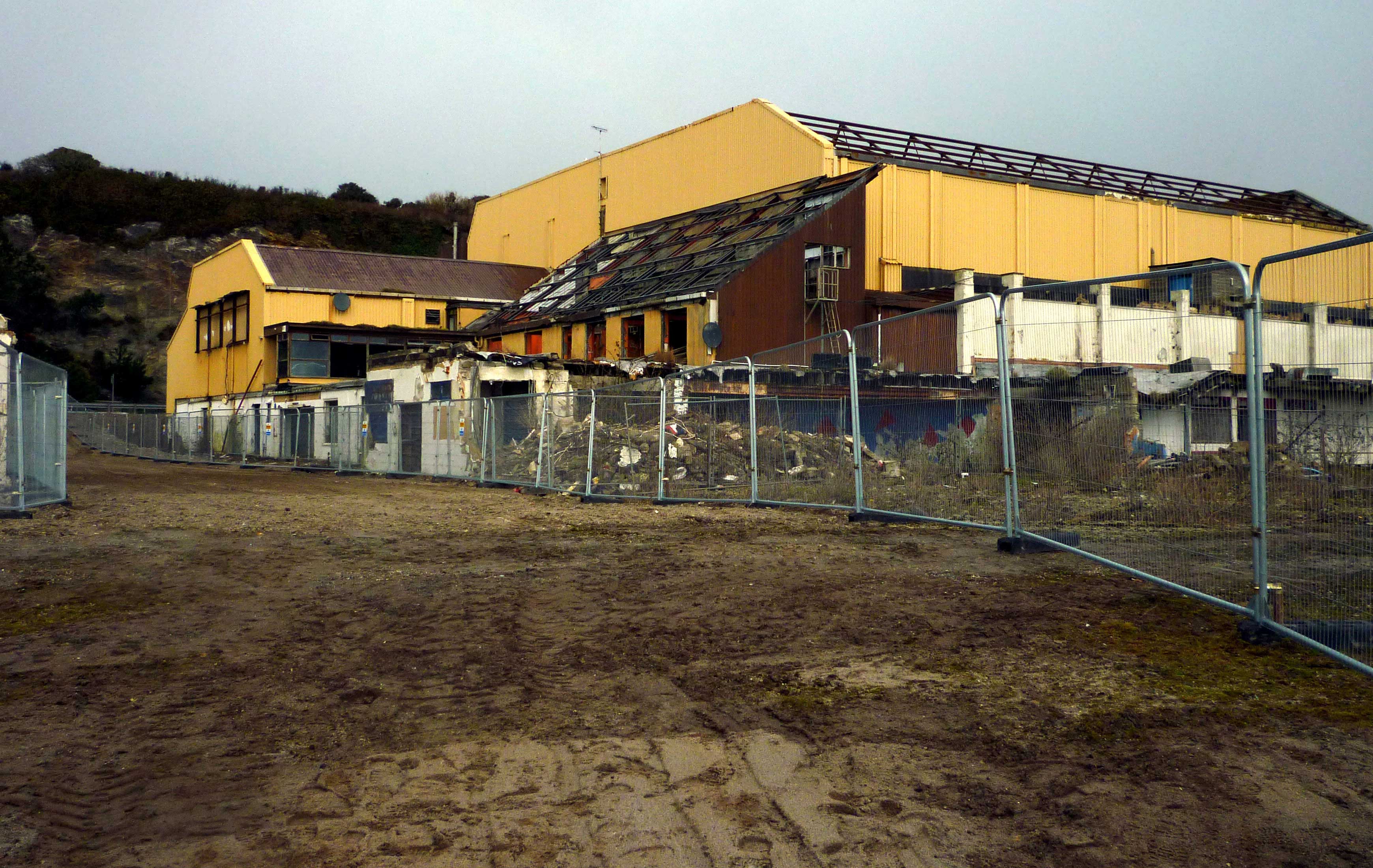
| WHAT IS POINT 14? |
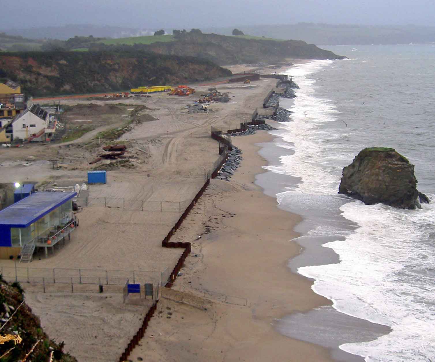 |
| This photo dates from before most of the shuttering was removed but it shows the information cabin at the bottom of the picture where rock armour and shuttering remain. The Public Right of Way is towards the top of the picture between the white and yellow buildings. As can be seen the high tide reaches this point first. The right of way ends roughly at the place where you can see a line of vegetation- this is the so-called Point 14. Beyond this CEG claim it as private land - so they erected temporary fencing. In January 2013 Cornwall Council approved extending the right of way beyond Point 14 to the foreshore. After CEG appealed, the issue is now to be decided after a Public Inquiry. |
That shuttering was finally removed in 2011 after CEG obeyed an Enforcement Order - but only after years of delay.
Finally after a comprehensive examination of the issues the Council's Countryside Access team recommended approving the extension - and on 28th January 2013 councillors on the footpaths panel voted for it unanimously.
CEG, as the landowner, appealed against that decision and the matter went to a Public Inquiry in June 2014.
BEACHES USED BY GENERATIONS OF FAMILIES
The beaches at Carlyon Bay have been enjoyed by the public for generations This letter was sent to Carlyon Bay Watch by Ron Hicks from Fowey, who was born in 1923.
"I can truly say I did on many occasions when I was about 9 years old and after, ride on old Raleigh roadster bicycle from Fowey to the beach at Crinnis - now known to some as Carlyon Bay beach and other individual names. Crinnis beach used to be considered to be the whole beach. Access to the beach was down a track, now the road, which stretched the whole length of the beach fairly close below the cliffs. The further along you went the more overgrown the track became. The wild plants, bushes and small trees contained a remarkable quantity of wildlife, small birds, rabbits, butterflies and numerous insects. The cliffs still contain a number of rare birds and other wildlife. This track was used by farmers to collect sand and seaweed from the beaches and in the mining period for the miners to reach their workings."
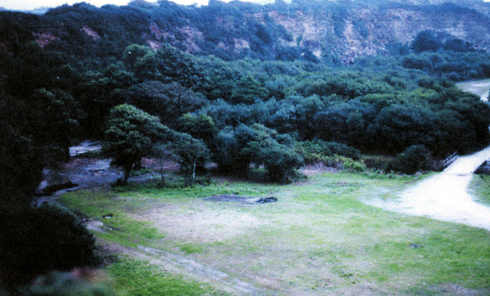 |
| Shorthorn, looking towards Polgaver, before paths and trees were bulldozed in 2004. A popular walking area. |
Sadly that and other tracks, along with the bushes and trees, have been destroyed by the developer.
CEG claims the paths were not public footpaths and now, because they have been bulldozed, it is impossible to demonstrate exactly the lines they took across the beaches - although they can be seen in old photographs.
The green areas at the back of the beaches were popular places for walkers and could be used when the foreshore was too inhospitable because of high winds and tides. They were also popular picnic spots where you didn't get sand in the sandwiches and were a haven for wildlife.
CEG claims that, as part of its massive development plans for hundreds of apartments and houses on the site, access will continue. But the paths used by generations of people have already disappeared under rubble and are fenced off and will eventually be buried under buildings. Any alternative paths across the beaches which may be incorporated in the design will only be accessible to the public by permission of the owners.
We believe that relying on this or any future owner to stick to those assurances would mean public access being by permission only and over time could be lost. This is the reason it's been so important to get access routes to the beach recognised as Public Rights of Way and enshrined in law.
For general enquiries email Carlyonbaywatch@aol.com