


|
|
|
|
|
|

 |
 |
||||||||||||||||
|
|
|||||||||||||||||
|
|
||||||

 |
|
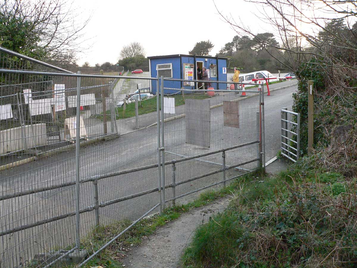
October 2008 - a lorry becomes stuck under |
CONSTRUCTION TRAFFIC
At the Public Inquiry in November 2006 the developer presented a Construction Travel Statement (CTS), stating that most of the construction traffic would be directed by the Site Management to use the Cypress Avenue route (from the A390, along Par Moor Road, Cypress Avenue, Sea Road North). It told the Inquiry that, in effect, any infringement of the CTS could mean a sanction being imposed upon the delivery contractor(s). However, despite very similar assurances having been given, experience during the construction of the sea wall to its present unfinished state during 2004 proved that the delivery contractors frequently ignored the developers directions and yet we heard nothing of sanctions being applied.
Carlyon Bay Watch's records show a number of complaints. Some were registered during the Focus Group meetings (from which Ampersand withdrew about 18 months earlier). The complaints were recorded in Minutes of those Meetings, whilst others were dealt with individually by the Construction Site Manager. The nature of the complaints varied from noise and vibration through damage to trees to the more important infringement of the school-hours embargo.
The problems were evident because of:
- The inadequate transfer of information to each contractor's and sub-contractor's staff and the very frequent driver changes inherent in the industry.
- Problems arising along the dedicated route, such as Par Market and Par Docks traffic and the general A390 chaos throughout, every Saturday in season.
- The nature of the haulage industry: if a load has been delivered and the next load is for a different client, it means that the driver must (because of tachograph constraints and high fuel costs) use the most efficient route to get to that next customer. This is particularly true of "own-account" drivers who must maximise the use of their vehicles.
South West Coastal Path
 |
|
The only entrance to the beaches is now a public right of way and crosses the South West Coastal Path at this point |
Evidence was given at the Public Inquiry suggesting that the impact of construction traffic upon the intersection between Beach Road and the South West Coastal Path would be "negligible". Yet the proposed sea wall would create an additional (we believe understated) 32,000 traffic movements across that intersection over 12 months - this would mean over 100 four-axle 32 tonne tipper trucks crossing the SWCP every working day.
The construction traffic for the whole development, according to Ampersand, would be 312,000 movements over four years (78,000 per year). This means that, in an average working day, with 300 working days per annum, there would be 260 trucks and vans crossing the SWCP every day - 29 vehicles per hour in a nine-hour day. But we all know about averages - there will be times of very little traffic and others of very heavy traffic, with resultant queues jamming up the road system.
One vehicle every two minutes crossing the South West Coastal Path (Footpath No. 36) mixing pedestrians with transport cannot be "negligible", and it must be a serious impact upon the public amenity and safety of a coastal footpath. The SWCP, it is agreed by the parties, enjoys National status.
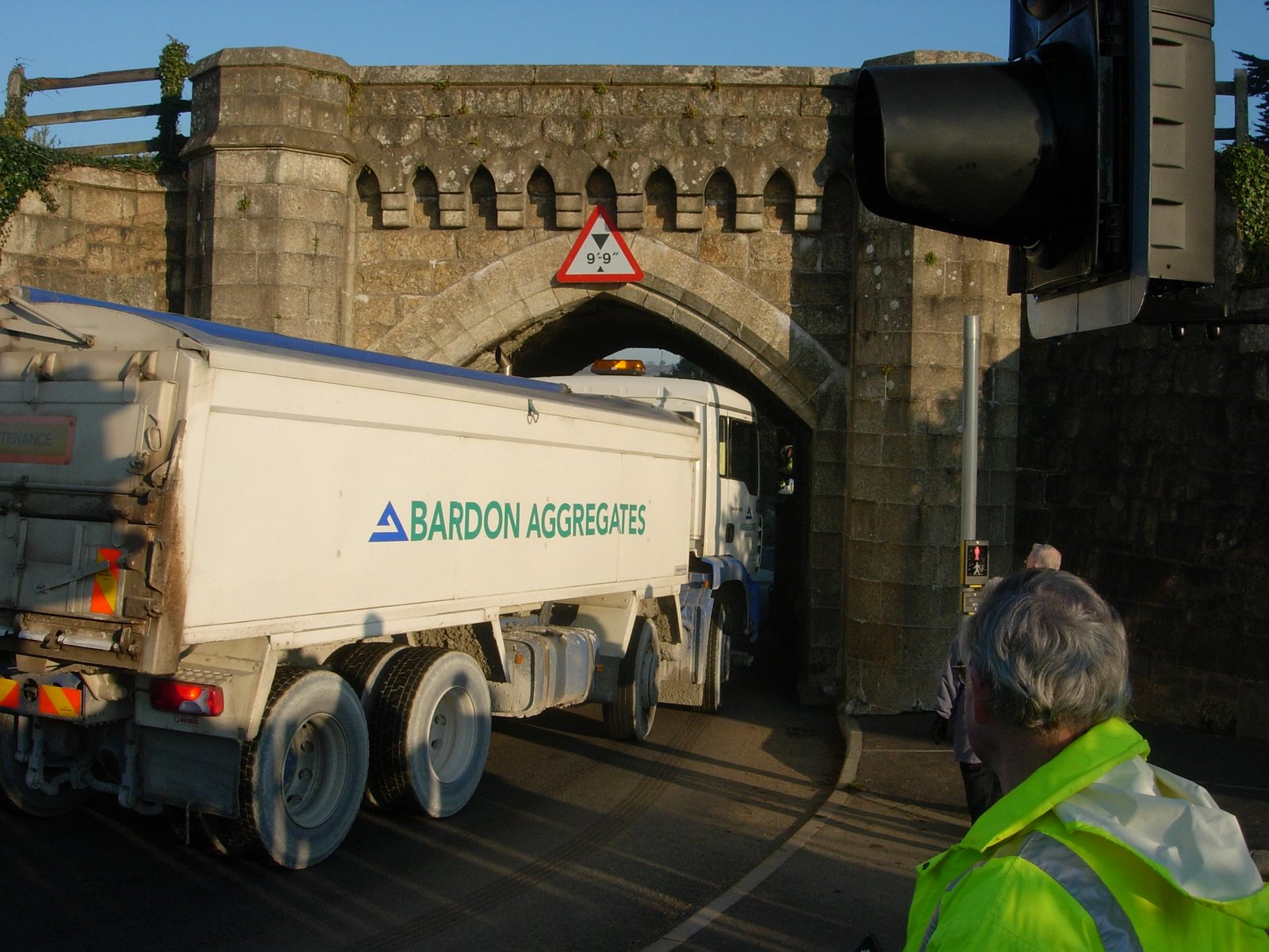
Most of those HGVs would also have to negotiate the railway arch and narrow road in Cypress Avenue, sharing it with local traffic and golfers using Carlyon Bay Golf Course. The developer says its trucks would be able to negotiate the low and narrow arch and staged a demonstration (right) to prove it - although the lorry got through with only inches to spare. But it is an awkward place and can trap the unwary (as shown above).
 |
|
November 2006 - test staged for the Public Inquiry shows minimal clearance through the arch |
The evidence to the Inquiry related only to the transport of 276,000 tonnes of stent to the seaward side of the steel shuttering of the wall. Carlyon Bay Watch is much concerned that there has been no debate about its landward side. It is correct to say that the extant wall would also require ballast on its landward side but, because the proposed design requires much higher levels of sand along the seaward side, this must require much higher levels of balancing infill material on the landward side to support the shuttering, to prevent it from falling inward.
Carlyon Bay Watch has no quantified evidence of this extra volume of fill, but from the fact that the new promenade would be at least 14 metres wide and 1,000 metres long, this suggests a difference in average height of the promenade of say 1.3 metres between the old and the new sea-wall designs. These figures suggest an additional 27,000 tonnes - an extra 2,700 HGV movements.
COMPLETED DEVELOPMENT
At the 2006 Public Inquiry, the Inspector made specific enquiry about the volumes of traffic to be expected from the scheme after its completion from holiday-residents, day visitors, staff and the suppliers of goods and services.
The developer submitted evidence about this question, but the evidence given by Carlyon Bay Watch on traffic-movement figures was accepted. Every movement to and from the beach must affect the A390 and it was agreed that the present volume of traffic using the A390 "Holmbush Corridor" was 9,900,000 movements per annum.
It was stated that expected traffic movements resulting from the completed development would average 5,000 plus per day - ranging over the year between perhaps as little as 2,000 or less, up to 8,000 or more in high season.
This would create a 1,675,000 extra movements annually, 17% on top of the 9.9 million movements already choking the A390 Holmbush Corridor. To evaluate that impact, one needs to refer to the March 2003 report by Bristol based specialist consultants Colin Buchanan Transport relied upon by the developer, to which we shall later refer.
Having now seen the developers projections for day visitor-numbers, Carlyon Bay Watch believes we may have seriously under-estimated our accepted evidence as to the average daily movement at 5,000 plus. One could be forgiven for thinking that the mere fact of its acceptance by the developer suggests it may have been understated.
BEACH ROAD
The developer claimed that Beach Road has "reasonably good highway standard", but omitted the fact that Beach Road traverses numerous mining stopes (at least a dozen), some wide, some deep, some both wide and deep. There will be some stopes that are un-recorded, because it was not until 1850 that there was a statutory requirement that they be recorded. There has been no testing to establish the stability of this road for the bearing of a very substantial number of heavy loads, or to support the developers assertions.
Much was made at the Inquiry of the use of signage to lessen traffic impact on the main distributor-road for Carlyon Bay, Beach Road. However, it would be very naïve to expect either the holiday-residents or day visitors to slavishly follow signage onto Cypress Avenue when they know (or would very quickly learn) that the sensible route to Charlestown, to the town centre, to Newquay, to Truro and beyond must be along Beach Road. This route passes the primary school, and the frequently single-track Church Road and then up Charlestown Road past the secondary school, or alternatively passes under the Holmbush Arch to the Tesco store. Whichever way these movements go, they must all end up using the A390 and, furthermore, when entering or leaving the site, there is just one narrow, steep road up or down to beach-level.
There was also some evidence given about parking provision on the car park just above the beach but what we did not hear then was that, under the terms of an Agreement reached between Carlyon Bay Hotel and the Developer regarding the use of Cypress Avenue, the quid pro quo is that, for five years at least, the Carlyon Bay Hotel has the right to use that top car park. If so, where shall all the day visitors park their cars ?
A390 TRAFFIC FORECASTS
The 2003 Colin Buchanan Transport Assessment, used in evidence to the Inquiry, stated that "trip generation for the Ampersand Group 2003 proposal (subsequently withdrawn) will be very similar to the trip generation of the proposal in 1990" (that means the so-called Extant scheme). One of its many telling phrases declares that "The Government has indicated that earlier forecasts had failed to predict and therefore underestimated the increase in car journeys".
That comment has been proven beyond doubt to be true, but there was a very detailed exchange of correspondence between Carlyon Bay Watch and Messrs. Colin Buchanan which confirmed that that "the trip generation will be very similar to the trip generation of the 1990 proposal." It was further agreed that the A390 corridor is working at its capacity, with saturation at peak times, and that minimising movements on the A390 is a high priority.
Colin Buchanan confirmed that they were not required by the County Council (within the scoping process of the planning application) to consider traffic growth to 2020, or to consider general population growth in Cornwall. The opinions formed by any consultants such as these are necessarily based largely upon snapshot measurement. Our evidence is based upon nearly 40 years of local in-depth personal knowledge and experience.
Further, those of us who use the A390 virtually every day are thus well aware that the developers submissions to the Public Inquiry that "Overall, the strategic road network does not suffer from any major capacity concerns" and that there is "generally significant reserve capacity in the road network" are categorically wrong.
As to the question of alternative travel, even if frequent public transport services were available to and from the site, we very much doubt that the average luxury-apartment dweller would wish to be herded onto buses with the rest of the general public and taken "around the houses" to their chosen destinations.
A part of the developers evidence to the Inquiry concluded that the proposed development will have "minimal impact on the highway network and will not adversely affect road safety, or the safety and amenity of relevant public rights of way". However, Objective 1 of the Governments Planning Guidance PPG 13 states that developers should: Promote more sustainable transport choices for both people and for moving freight. Consider the huge volumes of new traffic locally, consider also the huge carbon-footprint of the incremental traffic to and from all parts of the United Kingdom, and then ask oneself the key question arising from this guidance: Sustainable? We dont think so !
For general enquiries email Carlyonbaywatch@aol.com